Software Tools
Ecological, evolutionary, and spatial software to help characterize and visualize multidimensional rarity, range edge dynamics, and persistence under climate change.
Theory to application: Software tools as a necessity in modern ecology
Effective application of ecological and evolutionary theory requires vast amounts of geographic, trait, genetic, phenotypic, climatic, and phylogenetic data. Luckily, there are vast and open source big data resources, culminating in 15,409,681 trait records, 17,450,920 plot observations, and 520,197,375 herbarium specimens across 2,598,194 taxa, spanning all seven continents, over 270 U.S. national parks, and culminating in over one billion occurrences. These data are often collected by researchers and community scientists for public use; however, there is often a disconnect between data collection and data analysis/visualization and barriers to transforming community science into community action.
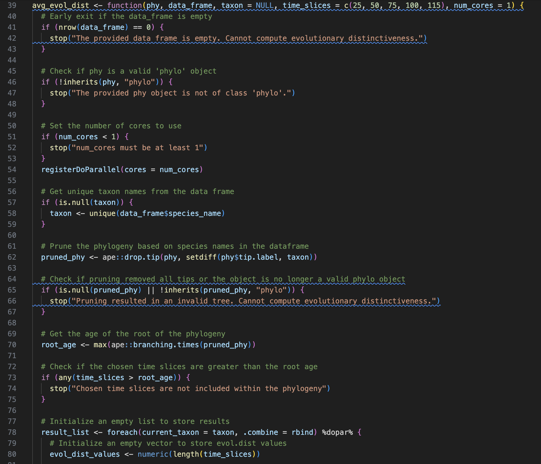
Bridging these gaps are more important than ever and possible through the creation of open source software packages, dashboards, and visualizations that reanalyze, repurpose, and combine data to gain broad insights, not possible when viewed through a single lens.
But really... what about application?
The application and integration of new scientific theories, discoveries, and guidelines is a slow and challenging process, especially at it relates to conservation. It can take decades to detect trends in vertebrate populations under climate change 1. By using computational approaches, we can rapidly process massive amounts of satellite, biodiversity, and climate data to accurately predict species' distributions, habitat loss, biodiversity hot spots, and climate shifts across spatial and temporal scales. These tools and insights can help researchers, policymakers, and communities make biologically informed management decisions. Whether it is a new way to implement evolution in species distribution models, a new way to predict the biodiversity of a community, or a new way to predict response to climate change using range dynamics, open source software provides an accessible tool critical to the application of modern ecology.
